
US States & Cities With the Best Summer Weather on Cool Maps
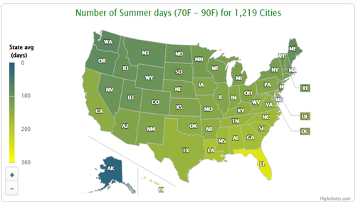
All temperature & precipitation numbers are averaged from daily data for the years 2000 to 2014, collected from the National Climatic Data Center. In cases where measurements were unavailable for the entire span, only areas with at least 60 months of data were included.
Averages were restricted to this period to give you a broad based, yet current snapshot of the weather in each area.
Some areas had one weather station collecting data, while others had a number of them. When there were two or more, we chose the one that represented the general weather best for that entry, rather than averaging them all together.
For example, some cities had specific areas with much higher rainfall, so those stations were not used because they would distort the overall picture. Still, no one station can sum up an entire location's climate 100%. Our map information is intended as a jumping off point in your search for a vacation spot or new home.
When a city is selected, just below its name is the "Station Location" we used.
Populations cited all come from the 2013 US Census estimate, available from the US Census website.
PPTX